FOREST PARK RAPID RESPONSE
PROJECT
Rapid Response Program
TOOLS
ESRI ArcMap
ROLE
Cartographer
TEAM
Solo
OVERVIEW
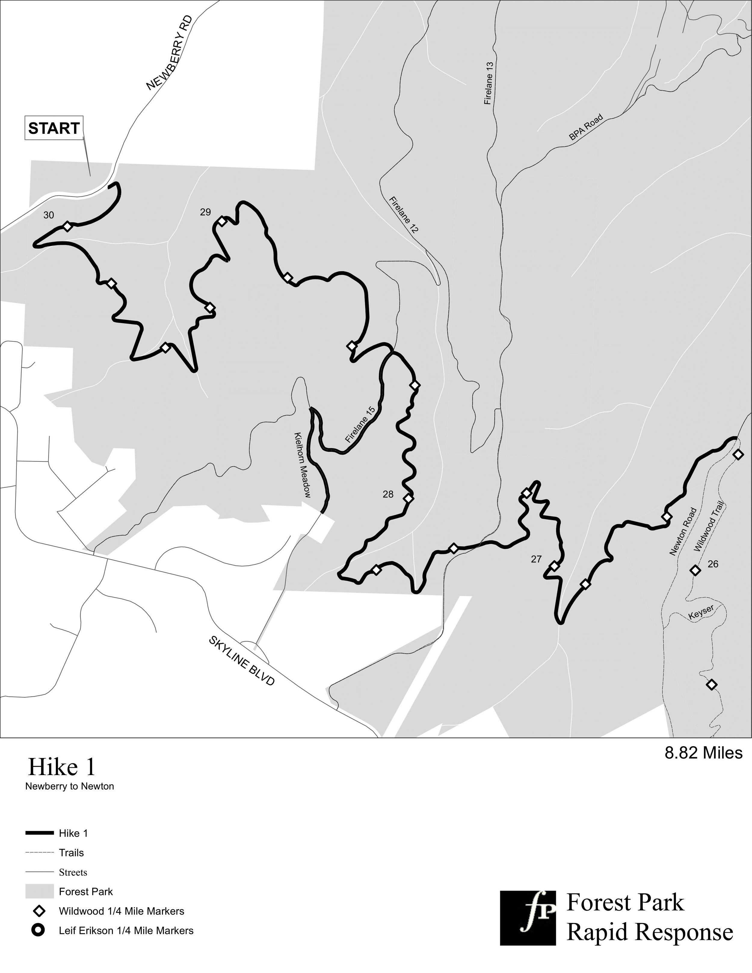
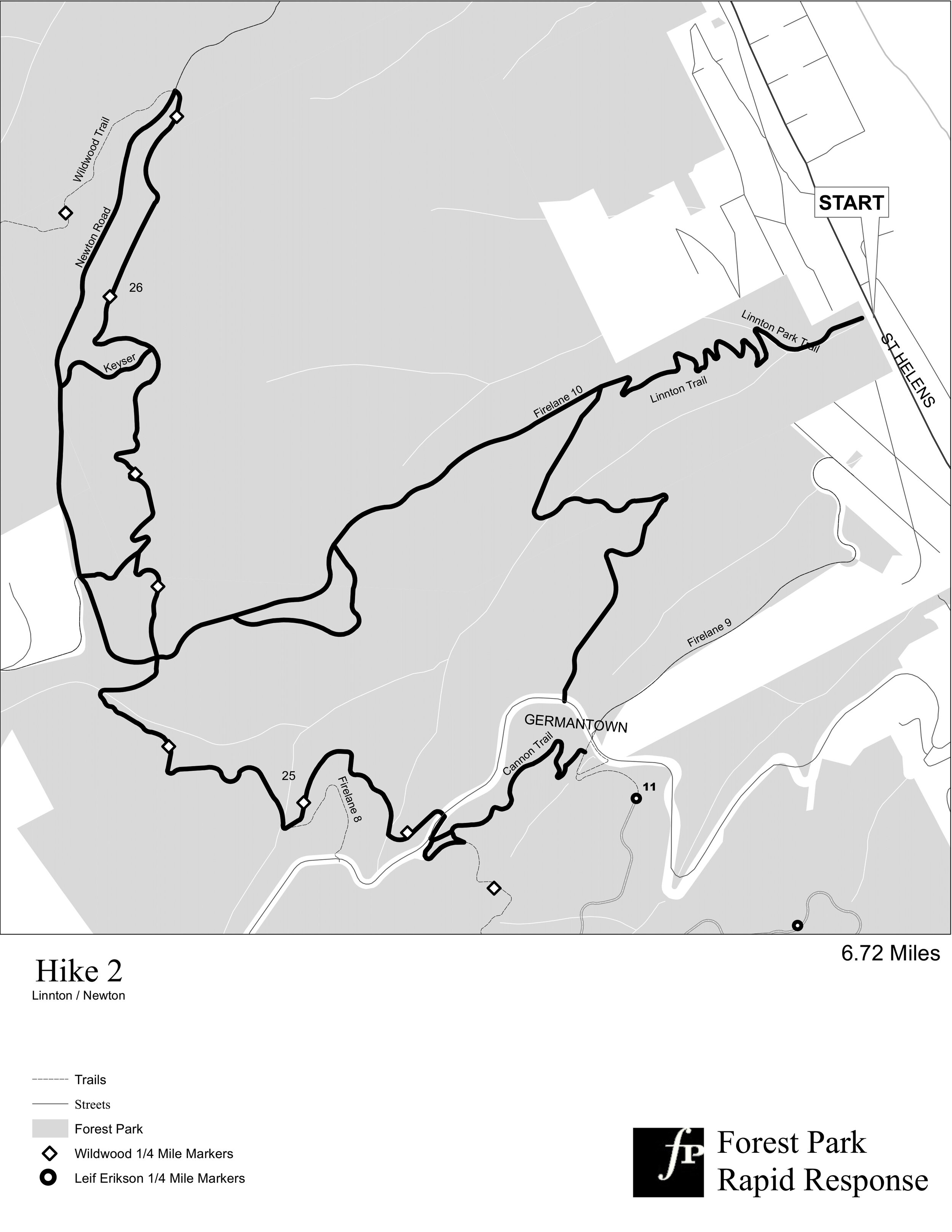
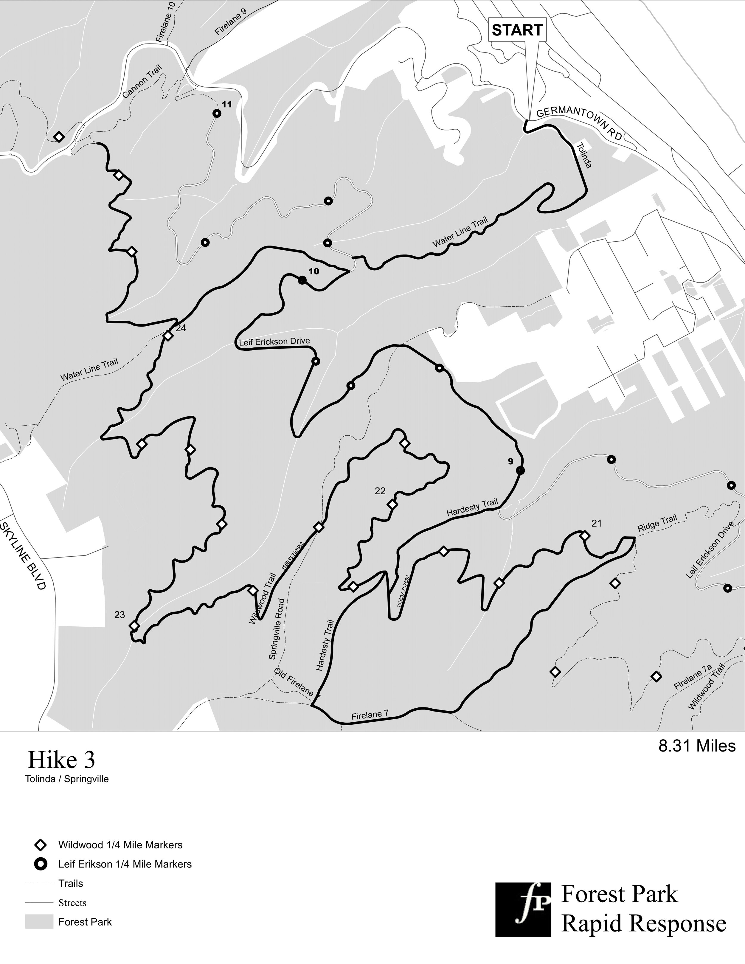
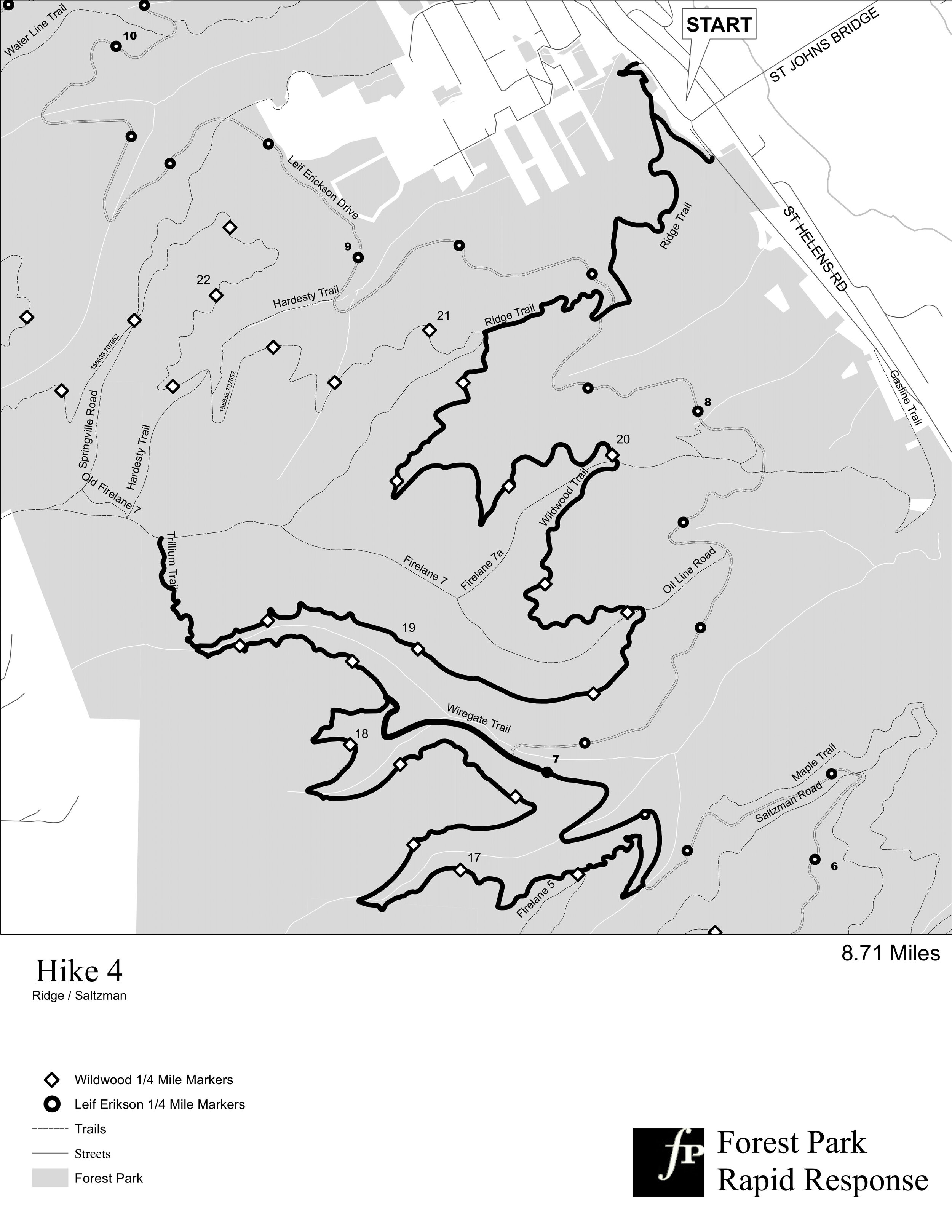
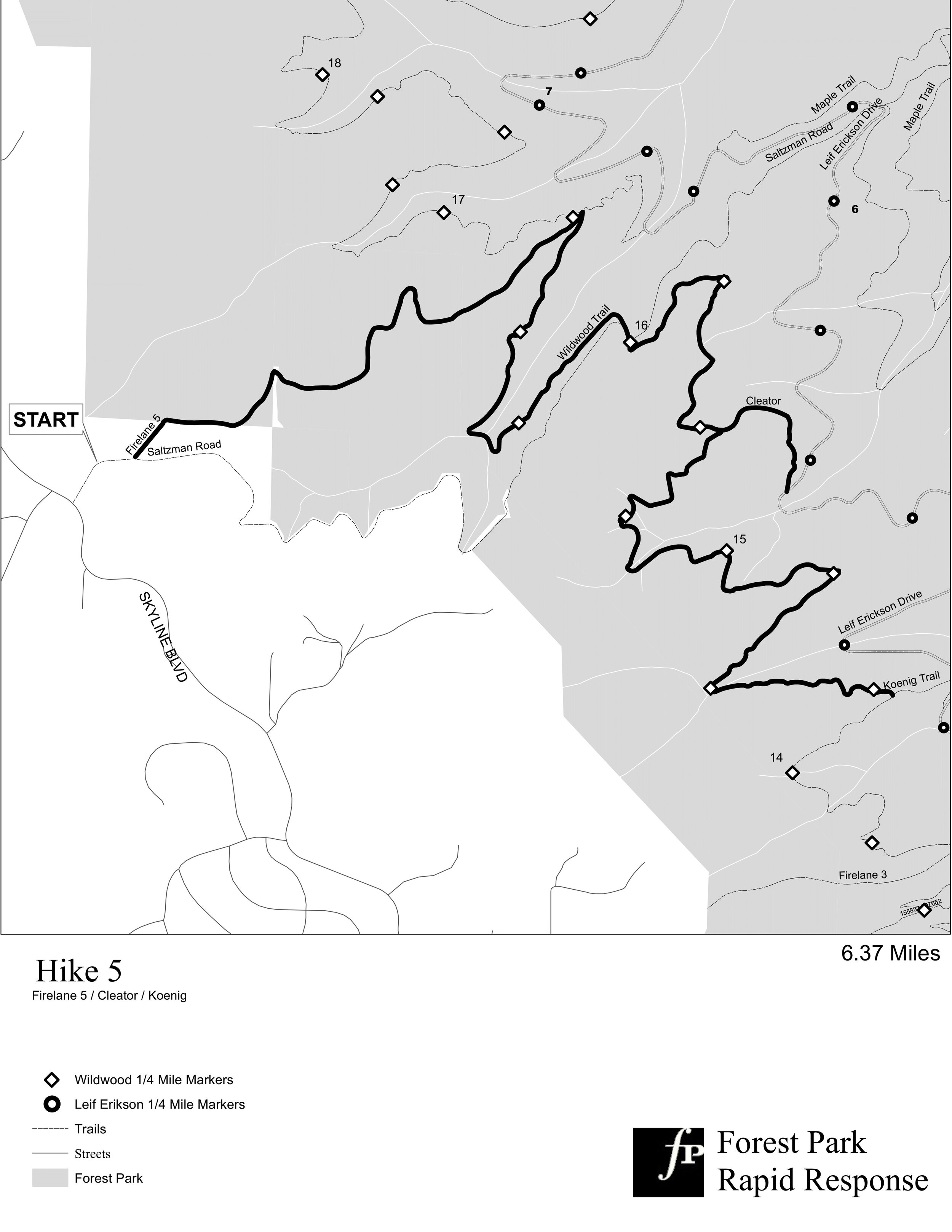
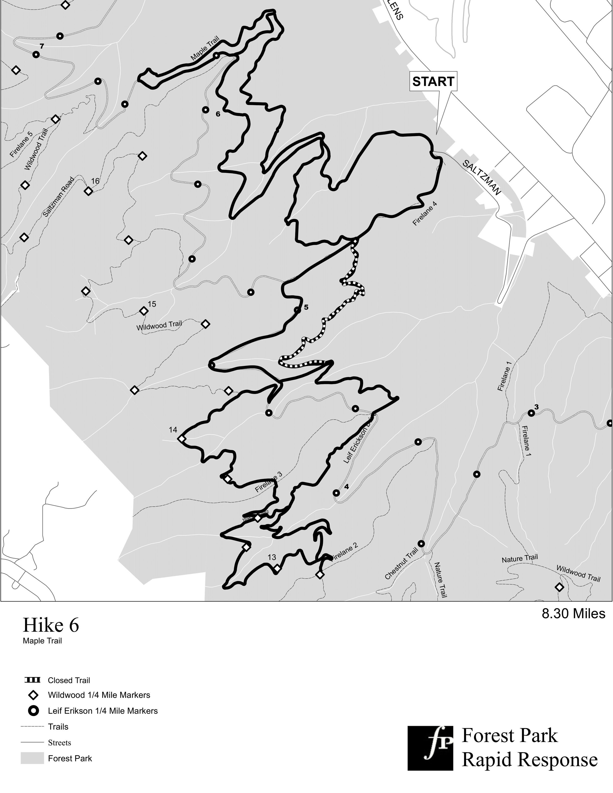
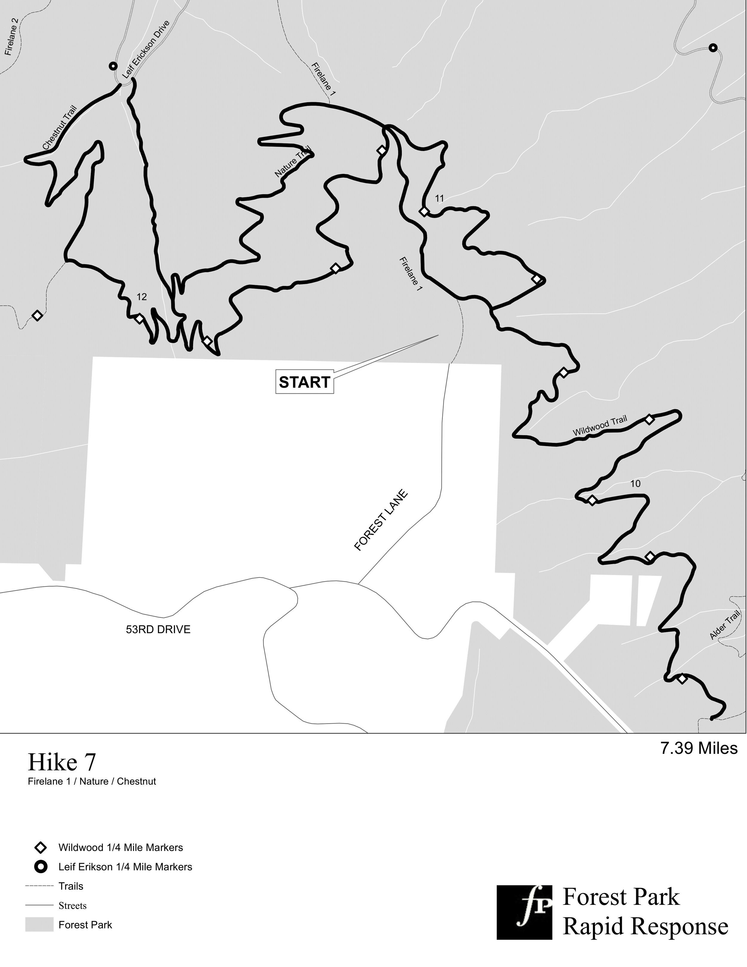
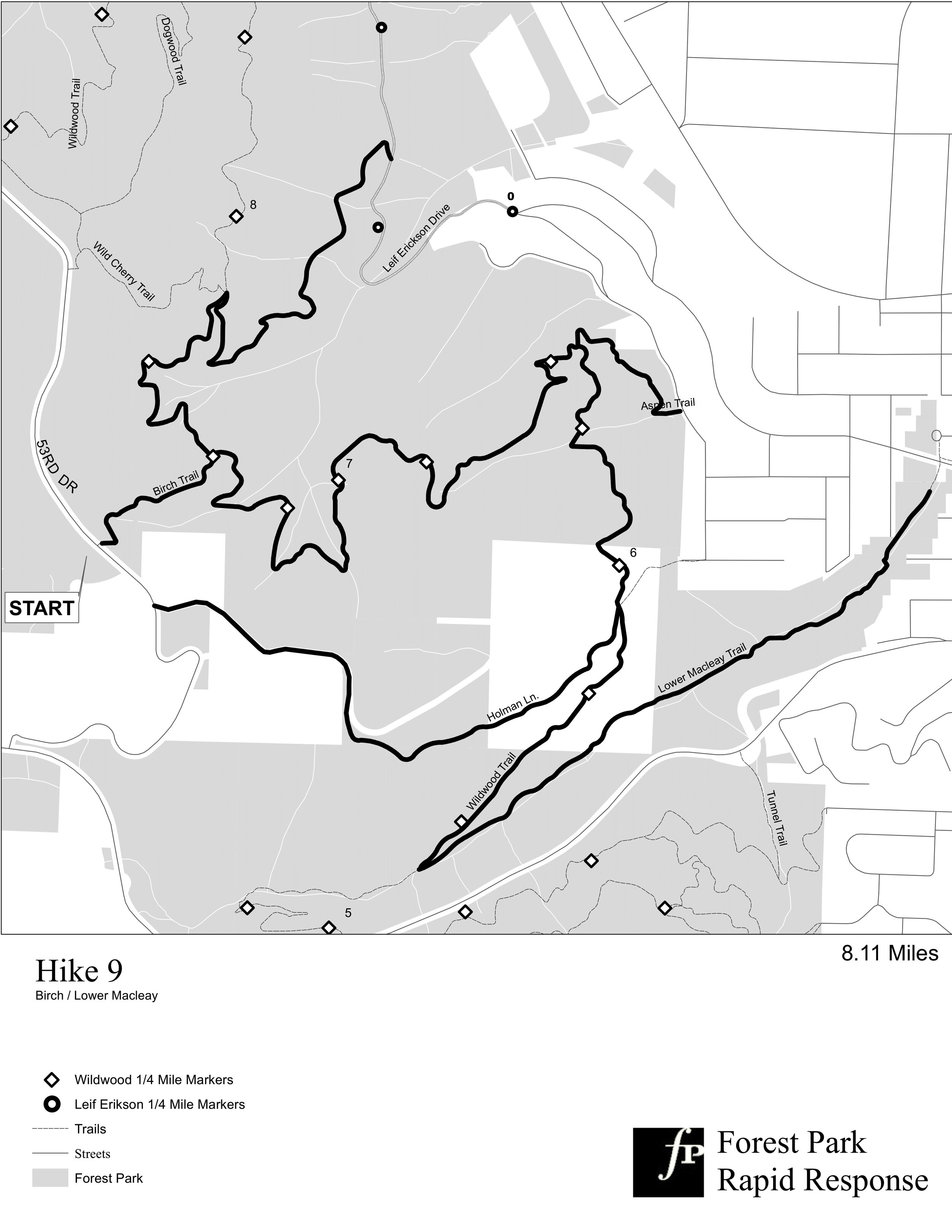
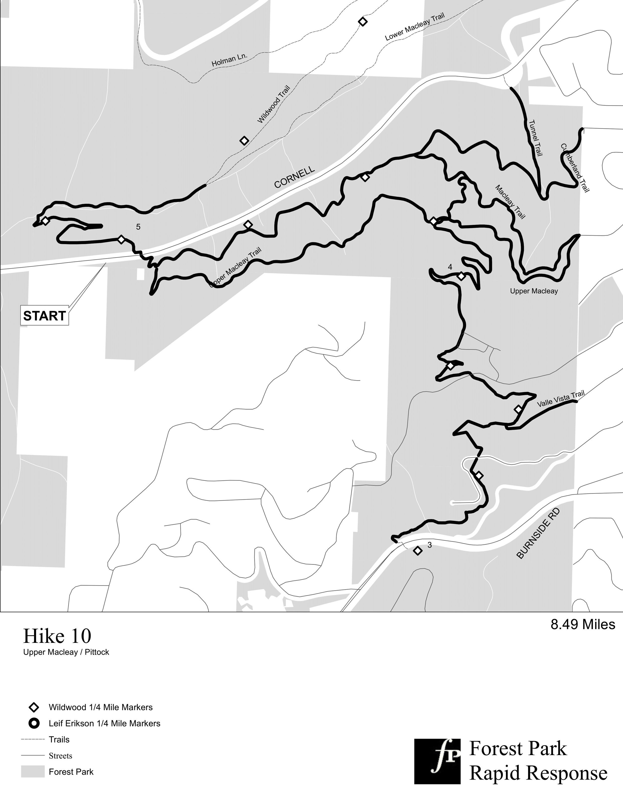
The Forest Park Conservancy’s Rapid Response program is made up of volunteers that survey all 47 miles of trail in Forest Park following storms. The information gathered from our Rapid Response Team members is used by Forest Park Conservancy to pinpoint and remove passage barriers and/or safety hazards on the trails of Forest Park. The program survey area was divided into ten different hikes for surveying. The maps produced for those 10 hikes are used by volunteers to navigate the 5,000-acre park to report hazards and disturbances. Working with only black and white cartography made these maps a challenge to highlight important areas. This challenge was overcome by using different shading and contrasts, allowing the final product was effective and usable for volunteers of the program.


LEARN MORE ABOUT FOREST PARK